I have wanted to do an Iron Butt Association sanctioned ride since I first heard about the organization six years ago.
At the time I had a 1999 BMW F650 with about 30k miles on it. While the 650 was a great bike in many ways, and I had done several four and five hundred mile days on it I was not up to doing 1000 miles in 24 hours with it. 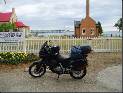 A weekend of camping and riding at Michigan's big bridge.
I started shopping for a bike to replace the beloved 650. Not having room or budget for two bikes, the 650 went and a 2001 R1150Gs with 22k miles took its place. After adding a few farkles and a couple of shakedown rides, the 1150 was shaping up to be a great bike for a SS1000.
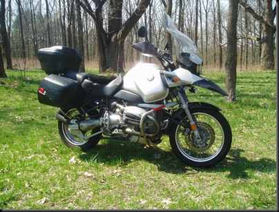
The GS a few months after I took delivery.
Long ago when I decided to do a SS1000 run, I should have seen a counselor. Instead, I decided to go around Lake Michigan for my 1000 mile run. I had played around with routes but never settled anything specific.
The week before I decided to leave, I hit the mapping software hard. I chose a route that that would predict my arrival time in Chicago and route up to the northern shore of the UP. In retrospect I should have come through Chicago at night instead of in the morning. Chicago is flat out ugly and crowded during the day, darkness could only improve it.
Another good reason for me to go counter clockwise; crossing the Mackinaw Bridge at night is rather boring. I have crossed the bridge many times on a motorcycle and I always look forward to the experience. I was very disappointed at my night crossing as it was a moonless, dead calm, very dark night. Looking east or west from the bridge was as dark as OJ Simpson's soul.
On the Friday morning before I left, my wife called from Chicago and informed me that I94 near Gary was closed due to flooding. She also said there was massive construction between Gary and Chicago. Not being a fan of construction traffic and detours, I made a last minute route adjustment to bypass Chicago via northern Indiana and Illinois only coming up through west Chicago to reach Milwaukee. This allowed me to run US 2 across the UP instead of having to go closer to the unpredictable Lake Superior.
Preparations; All that really needed to be done to the bike was an oil change and FD fluid change.
I made one last decision not to see a counselor and washed the bike instead. It didn't really need it as most of the bugs were only a few months old. I decided not to take my tank bag for this trip. I don’t like moving it to fill up with gas and I knew I would need at least 6 gas stops.
I planned on wearing my Kilimanjaro coat with liner, riding pants and boots, and winter gloves. I also took along my rain suit, waterproof riding pants liner, three other pair of gloves, a gator, and a sweatshirt. For tools, I had a flashlight, the stock tool kit, an extra tool kit, air compressor, and tire patch kit. If I needed more than that, I was in serious trouble. A couple bottles of water, a few small Ziploc bags with trail mix, vanilla cookies, pretzels, and raisins topped it off. I stowed a notebook for noting gas stops and times of breaks for the Ironbutt validation procedure. My wallet with the all important credit card was in the right hand pocket.
The first hour: I left the house at 6:00 am suited up and stopped at the Mobil station to get my official starting time by filling up and keeping the receipt. The time on the receipt, 6:14 am, was my official starting time. The pressure was on; I officially had 24 hours to drive around Lake Michigan and collect another receipt from the same city logging at least 1000 miles. All this for a license plate holder and a Lake Michigan Pin from the Iron Butt Association.
I headed south on I94 and an hour later I was making an exit from I 94 onto US31 South heading for northern Indiana.
The temperature dropped immediately as I turned away from the warming effects of Lake Michigan. I crossed into Indiana at 7:22 am. By the time I got to the North Liberty exit I was chilled enough to put on my extra sweatshirt. The lower speeds of highway 23 relaxed my pace enough to warm up and smell the fresh cut hay. The sunrise revealed low lying fog suspended over the fields.
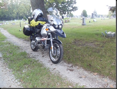
North Liberty was preparing for a yard sale when I arrived. There were lots of folks dragging folding tables in one hand and a coffee cup in the other. I found myself wishing I could stop and paw through some of the unwanted treasures and talk to the people. As it was I received a few interested stares. I don’t think big silver BMW motorcycles are an everyday occurrence in these parts. I took a small break in Walkerton Cemetery to finish off a bag of raisins and find a small Geocache.
Taking a short break in Walkerton Cemetery.
The third and very enjoyable hour was winding down to my first mandatory and scheduled gas stop in Winamac Indiana. The part of the journey found the scenery changing to corn. To do an official Ironbutt Association ride the route and mileage have to verify with receipts from gas stops along the way. If a route is “squared off”, a gas receipt needs to be collected from each corner of the square. I planned my route to go south of Chicago and hopefully avoid the construction and flooding. My plan was to stop in Winamac and Kankakee before heading north through west Chicago and up to Green Bay.
Hour four found me heading west on Highway 14. The roads seemed to be carved out of the corn itself. There were times the corn was so close to the road that I could put my hand out and touch the leaves overhanging the shoulder of the road. I crossed into Illinois at 10:15 and almost immediately found signs of flooding. In a few places the water looked to be in road the day before.
Riding through the cornfields of northern Indiana
I found the curve in Indiana! I was so excited I almost turned around and did it again!
I started hour five in a gas station in Kankakee Ill. Not a very nice place after rolling through the peaceful Indiana corntryside (pun intended). It is amazing how fast remote farms and seemingly endless corn can turn into an urban nightmare of traffic jams, loud cars, and rude people.
The traffic started to become more apparent as I pointed north to the Chicago sprawl. I traded my winter gloves for my favorite regular leather ones and I took the sweatshirt off while I had some trail mix, pretzels, and water. My original GPS planned route was to take I57 north to I294, a toll road. This is where things start to deviate from my best laid plans. The actual sabotage took place hours before, very likely at my first gas stop. The cause was a small check box on the GPS unit that I neglected to change before I left.
As I approached 294 the GPS was prompting me to exit right, long before the 294 exit. I ignored it several times and attempted to correct the course while riding. I finally decided I was spending too much of my allotted attention span on the GPS and highway signs, and not enough on traffic and motorcycle operation so I took the next exit that the GPS suggested.
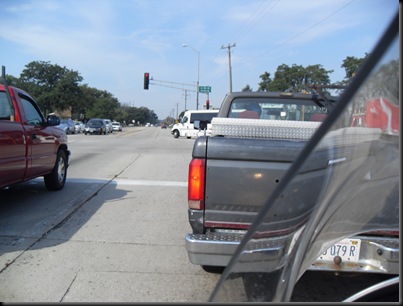
When I got off the highway I immediately found myself in a traffic jam due to construction, on a Saturday morning no less. I fiddled with the Quest while waiting to move in ever increasing heat. I finally shed my gloves and found the setting I was looking for. I unchecked the “Avoid Toll Roads” category and forced the GPS to recalculate. Unfortunately the next entrance to 294 was closed due to construction, and the one after that did not have a northbound entrance ramp from my direction forcing me to drive past, do an illegal U-turn and get on from the other way.
During this part of the trip I wished for a way to store maps in easy reach of the saddle. (this is also the point where I remembered my backup maps and printed route were laying on the kitchen table.) The tank bag would have been perfect, had I decided to take it. I am still not sure the hassle of the tank bag would offset the pia of moving it at every fuel stop. Of course, had the GPS quit working the decision could have been a disaster.
I had problems with a previous Quest which I sent back to Garmin for rebuilding. It lost all my routes, tracks, and waypoints while I was traveling in West Virginia. It was very near a disaster. Note for future rides of this type; find a way to store and display maps near the handlebars. Also come up with a way to change them at gas stops.
On this trip the Quest preformed almost flawlessly. The only times I had trouble was if I was asking it to do something else when it needed to recalculate; on two occasions it locked up when it was at 100% of a re-calc. I had to re-boot it each time. Both times it came right back without incident.
Hour six; After 31 miles of LaGrange traffic and spending an hour and twenty minutes traveling what should have taken me only twenty five minutes, I was back on I294. I was starting to get hungry but I was determined to make some time up.
From corn fields to traffic jams.
I had been on the road for over six hours and had only made three hundred miles. I still had seven hundred miles to go and only eighteen hours to do it. I was hot, my butt hurt, my wrist was getting tired and I was getting thirsty. On the other hand, that is what a SS1000 is all about; overcoming your discomforts and persevering to make the end I wanted.
After re-evaluating my situation, the worst was behind me; I did not have to go through Chicago again. I had freeway all the way through Green Bay, US2 across the UP and freeway almost all the way home from the bridge. The speed limits in Michigan were higher and I had a full eighteen hours to do it. Changes in attitude are everything.
While I was languidly cruising around LaGrange my GPS stubbornly insisted that I would still arrive home at 11:32 pm. Knowing I had several stops to make, I figured it would be 1:00 ish am before I got home. There was a bit of construction on I 294, as always. Twice I stopped to pay a toll and on the third I was distracted with construction, traffic, and lack of toll booth warning signs. When I finally saw the only sign, I was in lane three of four with the toll exits on the right. The traffic was moderately heavy and flowing about five above the speed limit. I may have been able to move over three lanes and catch the exit but I would be risking life and limb to do it. Before I had too much of a chance to consider it I was flying under the EZ-Pass detectors. I watched my rear view mirror until about Milwaukee and then mostly forgot about it until later in the week. It turned out to be the last toll stop before I94 which was toll free. (Update; I has been over month and the Chicago Toll Police have not dragged me out of my bed in the middle of the night. Yet.)
The next hour was uneventful, riding I94 out of Chicago and through Milwaukee. Traffic was light enough to move at ten over. About twenty miles north of Milwaukee I stopped for lunch at a Q Doba restaurant. I needed to cool off as the temps were running in the mid eighties from the time I entered Chicago.
I had a taco salad with steak topping. I don’t remember a salad tasting so good. I only spent about forty minutes languishing in the air conditioning but it was great. My socks were wet from sweating in my riding boots. Note to self, next time bring at least one more pair of socks, maybe two or three. There is plenty of room. Or buy the under armor socks. I will regret not having dry socks a few hours later. I took my boots off while eating to let them dry out a bit.
I was getting anxious again; It was almost 2:30 PM; eight and a half hours into my journey and I still had not broken the five hundred mile mark. Despite the optimistic GPS, I still was not sure if I could do it. As I prepared to re-mount the silver steed, I took off my riding pants, jacket liner, opened jacket vents, and switched to my summer gloves. The temps were staying in the 80's and I didn’t want to get too sweaty when I knew I would have ride late into the night. I also knew the temps would drop when I hit the UP. I was surprised at how quickly that change came.
I started the bike at 3:00 PM and pointed it toward a gas station. At 3:04 PM, the beginning of hour nine, with a full tank of gas and feeling refreshed I was determined not to stop until I needed gas again.
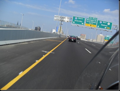
Aiming for Green Bay.
Just north of Green Bay the terrain went from suburban sprawl to trees and fields. I even got a few glimpses of Lake Michigan or Green Bay water. The wind picked up a bit from north of Milwaukee to Green Bay causing some whitecaps out on the water. I briefly wondered if I would get some rain to go with the wind. As soon as I rounded the corner and started heading east the wind stopped and my worries were redirected.
The opinionated GPS reared its ugly head again about halfway through hour ten. (Garmin must have a German programmer!) A few miles north of Green Bay it decided to route me through a shortcut; US41 took a big sweeping right hander and headed into the U.P. Lakeview Drive cut across the curve at a diagonal making the GPS believe it was the fastest route.
This time I didn’t argue too much as I had been on the highway since Illinois and some two lane roads might do me some good, so I exited as suggested. When I reached the stop sign after exiting, I pulled out just behind a guy on an obnoxiously loud and flashy chopper.
My route was supposed to take me left on a road about a half mile from the exit. As I approached the intersection I could see the dreaded road closed and detour signs. As I rolled up to the signs, Mr Obnoxious turned left onto the closed road along with another car. I considered it for several moments weighing my options and decided to turn back and return to the highway. Just before the highway entrance was a two lane road that paralleled the freeway for a ways. For some reason I decided to take that road. (At some point in my life I will have to re-evaluate my decision making processes.)
There are moments in my life I should do the opposite of my first thought. Back to the story. I followed that road for a while when I came to an intersection. The freeway was not an option here; I could go straight and parallel the freeway or turn right and see if I had passed the construction. I chose right. When I arrived at the road, there were no road closed signs, no detours, and a very nice freshly tarred road. I turned left believing I had bypassed the construction. I was rolling along about sixty five ish, went the road went from tar, to gravel, to hard dirt, to not so hard dirt all with in about a quarter mile. The road seemed to end by a railroad track. Off in the distance I could see chopperman riding on the other side of the tracks on a gravel road.
(This seemed like a surreal moment; a flashy and obnoxiously loud chopper on a gravel road. Even worse, he had to cross the loose dirt and railroad tracks to get there. I have known guys that turned around on much more capable bikes.) Unfortunately I did not get any pictures or movies.
On further inspection I could see a dirt two track winding between mounds of sand, across the tracks and leading to the gravel road. Well, if he can take a chopper through that, I can surely do it on a GS bike built by the sovereign BMW Korporation. (Klick your heels and salute!) Dropping the bike in first gear I easily made it across the tracks and was soon following the chopper dood on a limestone gravel road. The loose gravel was running from one to two inches in diameter making it hard to handle the bike at low speeds behind the chopper. I decided to pass, giving him a wide berth on the left side. As I passed I saw his left hand come off the hand grip and move up. I still am not sure if it was a friendly wave or if it was an ADV salute and I didn’t stay long enough to see.
As soon as the bike got some speed up the handling was much better and I limited myself to fifty mph. The gravel went for another mile or two before I was able to get back to my normal cruising speed. Another five or six miles and I was back on the highway.
The scenery was changing to the northern climes standard of pine trees and low lying swampy areas. For a while the bugs were determined to avoid the coming winter by committing suicide on my windshield and helmet.
The temperatures were dropping from the time I entered Green Bay. When I got back on the highway it was clear I would have to stop and put on some layers. I wanted to wait until a gas stop but I was starting to get a bit hypothermic and I didn’t know how much more the temps would drop. The beginning of hour 11 found me at a connecting road closing vents, putting on winter gloves, riding pants and draining my bladder. I only stopped for about eight minutes but I felt much better. 
Stopping to add layers.
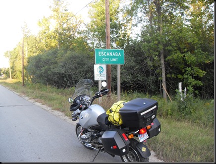
Forty minutes later I made a quick gas stop and continued on my way into Michigan. Gas in Wisconsin was in the 3.62 range and I knew when I crossed into Michigan it would go up. For once I was right; gas went to 3.79 when I crossed the boarder and increased to 4.07 by time I made the bridge. I made very good time for the next couple of hours. I barely noticed the twelve hour, half way time, slip by. I was more concerned with the dropping temps and ensuing darkness. I passed a few bank temp signs and they claimed it was getting to 55 degrees. If it dropped much more knew I did not have the proper gear to deal with it.
By 8:30 pm I was starting to get hypothermic again. I decided to stop at a Big Boy and get some hot food into me. I could re-group and come up with a plan of attack after I ate something warm. Big Boy had a buffet and I filled up with coffee (an iron butt no-no), shrimp, mashed taters, fried chicken, roast beef, and ham steaks. After three trips I was so stuffed I couldn’t even look at the food anymore. The waitress was nice enough to bring me a squirt bottle and paper towels for my bug encrusted Scorpion.
The weather channel was on the TV opposite my booth and the temps were not supposed to drop below 55 overnight with no rain in sight. The bridge was under one hundred miles away and the temps would probably go up once I got to the lower p.
I went out to the bike and put on the rain liners under my riding pants, sweatshirt, jacket liner, neck protector with the chest thing and cold weather gloves. If I needed to, I could also put on my rain suit. I was ruing my wet socks as my feet had a tinge of cold. I stopped for a fill up, turned the handlebar heaters to high, lit up the driving lights and headed off into the night.
I arrived at the bridge about 9:50 pm. It was a comfortable albeit boring ride along US2 in the dark. The only live critter I encountered was a porcupine scurrying along the left shoulder of the road. We chose not to interfere in each others lives. My fingers were a bit chilled in spite of the handle bar heaters and winter gloves. I stopped at the overlook park to get a couple shots of the bike with the bridge lights in the background. While there I took the opportunity for a brisk walk for about ten minutes. I figured some exercise would get my blood pumping and possibly warm up my fingers.
Mackinaw Bridge and my silver taxi.
At 10:00 I pressed the starter on the bike and made my way across the bridge. By 10:12 I was in the lower p and only four hours from home! It was at this point I knew I would make it. The 11:00 hour found me in a gas station in Grayling. The temps were in the lower 60’s and there was almost no traffic. With the speed limits in the Lower P being higher than the other states, I was making great time. After a fifteen minute rest I was back on the bike and on my way.
By this time I was starting to get a bit punchy. I was trying do some simple calculations in my head to keep boredom out. I discovered my normally substandard math skills were even worse than normal.
About midnight I jumped off the freeway near Houghton Lake and took the two lane over to Cadillac and onto 131 for the rest of the way home.Around 12:30 I noticed the dew was starting to settle. I could feel the dampness and see it as a light fog in my driving lights. As I approached Rockford I was trying to calculate if I would have enough gas to make it home. I had about one hundred and thirty miles on the current tank and I was averaging one sixty to one ninety between fillups. I knew I should be able to make it if nothing out of the ordinary happened.
Just to be safe I pulled into a Meijer station in Rockford around 1:30 am and topped off the tank. This was the time that the credit card company decided to suspend my credit card and I had to use my backup. I was glad I filled up in Rockford as the exit to I96 was closed due to construction. I had to drive about eight miles south and use M6 to get back to I96.
At 2:21 am I pulled into the Admiral station in Zeeland to do my final fillup. The total GPS mileage was 1032, the bike registered 1097.

